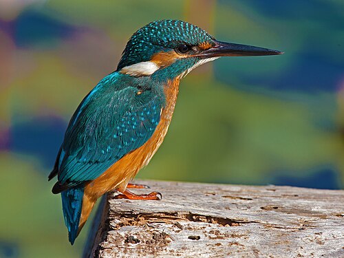
 Common kingfisherAlcedo atthis
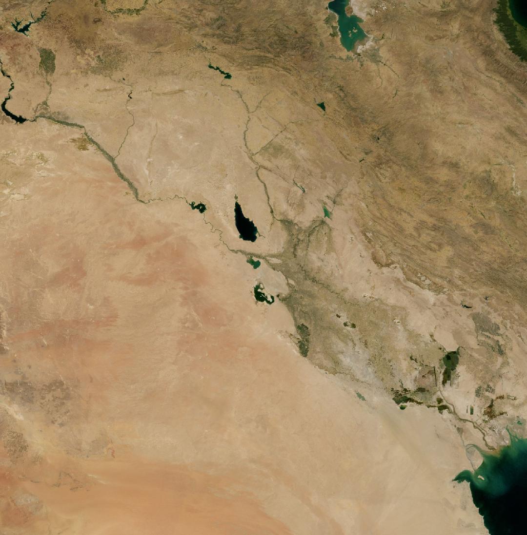
Iraq
A country in western Asia, between the Tigris and the Euphrates.
Image: NASA Blue Marble. Borders: Natural Earth.
Iraq lies around the Tigris and Euphrates rivers, in the land once called Mesopotamia. Mountains rise in the north east, deserts cover the west, and in the south the two rivers meet in the Mesopotamian Marshes before reaching the Persian Gulf.
The marshes are one of the largest wetlands in the Middle East and a UNESCO World Heritage Site. They were largely drained in the 1990s but partly flooded again, and they are vital for migrating birds and for the Marsh Arabs who live there.
Iraq
- Capital
- Baghdad
- Population
- 38.3 million
- Area
- 437,072 km²
- Continent
- Asia
- Highest point
- Cheekha Dar, 3,611 m
- Languages
- Arabic, Kurdish language
- Currency
- Iraqi dinar
- Time zone
- UTC+03
Figures from Wikidata; population 2017.
Iraq in pictures


Which animals live in Iraq?
Among the animals recorded in Iraq are the common kingfisher, the western honey bee, the peregrine falcon, the red fox and the leopard. These are wildlife records shared through GBIF, not a full list of the animals that live here.
Common kingfisherAlcedo atthis Western honey beeApis mellifera
 Peregrine falconFalco peregrinus
 Red foxVulpes vulpes
 LeopardPanthera pardus
What is putting pressure on nature here?
Dams upstream and drought have cut the flow of the rivers, and the marshes are drying again. Water is polluted, dust storms are increasing, and the country is among those most exposed to climate change.
Learn more about Iraq
Iraq on the living planet
Keep exploring from Iraq
Species pages with records from Iraq
Common wood pigeonHooded crowEurasian magpieEurasian skylarkEurasian blue titEurasian nuthatchLong-tailed titRed foxThrush nightingalePurple loosestrifeGarlic mustardHemp agrimony
Countries nearby
Sources and photo credits
- Wikidata · Iraq (Q796), facts and national parks
- Convention on Biological Diversity · Iraq country profile
- GBIF · human observations in Iraq, used to choose the species
- Natural Earth · country borders, public domain
- NASA GIBS · Blue Marble imagery, public domain
- Euphrates, Iraq: YG01, CC BY 4.0
- Tigris, Iraq: Dûrzan cîrano, CC BY-SA 3.0
- Arabian Desert, Iraq: Aidas U., CC BY 3.0
- Syrian Desert, Iraq: Vyacheslav Argenberg, CC BY 4.0
- Great Zab, Iraq: jamesdale10, CC BY 2.0
- Common kingfisher: Artemy Voikhansky, CC BY-SA 4.0
- Western honey bee: Vasily Reinkymov, CC0
- Peregrine falcon: Georges Lignier (georges.lignier@wanadoo.fr), CC BY-SA 3.0
- Red fox: ClaudiaTen, CC BY-SA 4.0
- Leopard: Sumeet Moghe, CC BY-SA 4.0


Borders and the capital show where Iraq is. Wildlife records show where people have seen animals, not where they all live today.
Checked 2026-11-19.